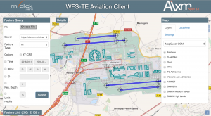
Lightweight, web based Aviation Client application for aeronautical information portrayal and visual data validation. It supports multiple map layers (for weather and terrain data) and provides a tool for spatial and temporal WFS 2.0 query building with support for WFS Temporality Extension (WFS-TE).
The m-click.aero web client features:
- Webbased Tool for Situational Awareness, Planning and Reporting.
- SWIM compatible AIXM data retrieval via WFS 2.0
- Manage and display Digital NOTAM Events
- Visual representation of static aeronautical data from different sources
- Display of weather charts
- Query building tool (WFS 2.0, WFS-TE)
- 3D Globe view

